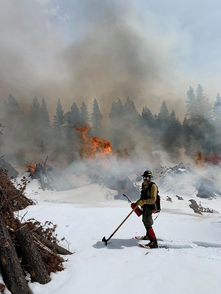
I'm a volunteer fire fighter in the Colorado Rockies, and disaster responder. This is large rural district up in the mountains of Colorado. For decades we used huge mapbooks, which due to cost, never got updated. Once digital mapping became common, we discovered Google had about half the addresses, and about half the roads. As an engineer I decided I could fix this, thanks to OpenStreetMap. I did a talk at SOTM-US in Tucson about this project called OSM For Fire Fighting that discusses this project.
Where I live, there isn't any dependable cell service, so offline mapping is mandatory. Paper maps have a few advantages, it's easier for a group of people to look at a map together than it is on a GPS or Smartphone. Also paper maps don't have problems with battery life. We cover several hundred square miles, most of it national forest or mountain wilderness area.
Old-timers in my department of course know everywhere and everything. :-) But new fire fighters have a huge learning curve. We have many "community trails", and campsites, ie... not on any map. Around here that nasty looking jeep trail with no sign is actually somebodies long driveway. That and specialized locations useful to us, like water sources, or helicopter landing zones.
I've been into offline digital mapping for a long-time, but these days the technology has gotten much better. Gone are the days I had to use a physical GPS device attached to my laptop, plus sufficient battery storage to last long enough to be useful. There's been a few times I got saved on trips because I had this capability. Like finding the nearest gas station when lost in the wilds of Tasmania. Yes, my co travelers on that trip were very happy when we pulled into the only gas station for a long way.
Another time we were lost in Albania on a speaking tour at Universities cause the dictator wouldn't allow maps, and there weren't many street signs either. Google maps would cache a few tiles if you were careful, and conveniently, many gas stations and restaurants in Albania have wifi service. So we were saved.

These days though the tools for offline mapping are great. With sufficient disk storage and a decent processor, you can make your own maps with whatever custom data you want. As a fire fighter and climber, (and conveniently software engineer) I focus on the areas we respond to, local dispersed campgrounds, back-country trails, climbing or skiing accidents, wildland fires. Along with that water sources are really important to us, as we have few fire hydrants, and we often use helicopters for medical emergencies.
I'll go into the tech details on another page, but the brief summary is I'm using OpenStreetMap data I've got running in a local postgres database, and wrote my own utilities for data format conversion. One of the big problems I've had is that all of the websites that convert GIS files have limits on size, any my files were way larger. That and the various open source programs had issues with supporting all the same versions of each format, so details were getting lost. Finally I wanted something that I could use when working fully offline in the field. For a big disaster or wildland fire, the maps are very dynamic and change every day.
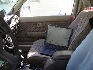
Most rural volunteer fire departments don't barely have IT support, much less any money... I've been producing custom data extracts for the local rural fire districts here in the Colorado Rockies. Multiple fire departments around here have gone to mounting tablets in fire apparatus to work as a dedicated mapping device, with the same maps on their phone.

As most GIS files are huge, being able to extract subsets to work with is critical. Polygons are used to extract these subsets. Sometimes, depending on the task, I draw freehand polygons, but for many tasks, I use the official boundaries. All of these polyfiles are produced from official government data shapefiles, using a mix of my own software, and other open source tools. That process is documented in this workshop presentation, OSM Data Manipulation. Many of these boundaries already exist in OpenStreetMap and were imported from these same sources, although sometimes from older versions. To save people the trouble, here's the ones I use. Because map data files are often huge, being able to slice up the files makes it much easier to edit the data.
Since I'm focused on maps for emergency response or recreational purposes, things like roads and trail data is really important. My rural area is well mapped after years of work, but since I had the data for the entire US, I figured I'd make it available. When possible download any original data files from their source, as they're huge. I've included all the converted files for anyone that wants work on their own area. Included is documentation on the conversion and import process. The files are here.